IRIS Webicorder
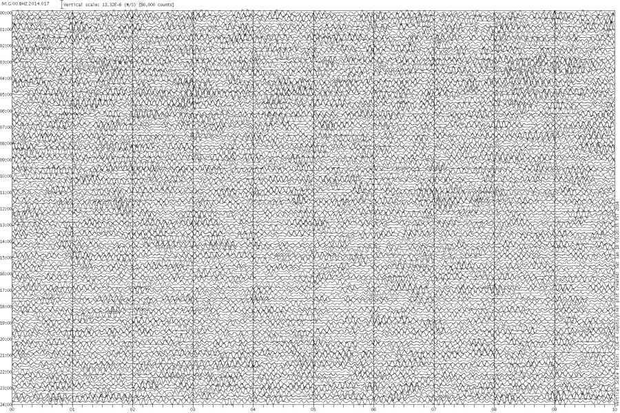
Network G : GEOSCOPE
Station : IVI : Ivittuut, Greenland : GEOSCOPE
Latitude : 61.21, Longitude : -48.17
Elevation : 15m
Instrument : STRECKEISEN STS1 + METROZET E300 ElectronicsLocation
Location : 00
Channel : BHZ
The Geoscope Network produces day long graph of signals, via the IRIS DMC. The IVI station is on the Southern coast of Greenland. Some large Global quakes can be traced on these graphs also, usually shown as a long low wavy line. Unless marked with the location the majority of the traces are within a few hundred kilometres of IVI and may include quakes in Greenland, Iceland, the Newfoundland/Labrador coast of Canada and Hudson Strait. This webicorder is particularly susceptible to being affected by North Atlantic storms. The link page for other years is here.
Each graph is identified on the image itself by the day number 1-365, and you can look up the normal calendar equivalent date using this table. Click any image to start the slideshow. Browser specific slideshow instructions
If an image is missing it was not collected for technical reasons. This archive commences on the 1st January. The link page for other years is here.
The current last image may be that last available as the recorder appears to have been taken out of the public domain.
-

- IVI.G.00.BHZ.2014.42

-

- IVI.G.00.BHZ.2014.41

-

- IVI.G.00.BHZ.2014.40

-

- IVI.G.00.BHZ.2014.39

-

- IVI.G.00.BHZ.2014.38

-

- IVI.G.00.BHZ.2014.36

-
- IVI.G.00.BHZ.2014.35

-

- IVI.G.00.BHZ.2014.34

-

- IVI.G.00.BHZ.2014.33

-

- IVI.G.00.BHZ.2014.32

-

- IVI.G.00.BHZ.2014.31

-

- IVI.G.00.BHZ.2014.30

-

- IVI.G.00.BHZ.2014.29

-

- IVI.G.00.BHZ.2014.28

-

- IVI.G.00.BHZ.2014.027

-

- IVI.G.00.BHZ.2014.026

-

- IVI.G.00.BHZ.2014.025

-

- IVI.G.00.BHZ.2014.024

-

- IVI.G.00.BHZ.2014.023

-

- IVI.G.00.BHZ.2014.022

-

- IVI.G.00.BHZ.2014.021

-

- IVI.G.00.BHZ.2014.020

-

- IVI.G.00.BHZ.2014.019

-

- IVI.G.00.BHZ.2014.018

-

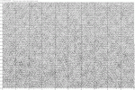
- IVI.G.00.BHZ.2014.017
-

- IVI.G.00.BHZ.2014.016

-

- IVI.G.00.BHZ.2014.015

-

- IVI.G.00.BHZ.2014.014

-

- IVI.G.00.BHZ.2014.013

-

- IVI.G.00.BHZ.2014.012

-

- IVI.G.00.BHZ.2014.011

-

- IVI.G.00.BHZ.2014.010

-

- IVI.G.00.BHZ.2014.009

-

- IVI.G.00.BHZ.2014.008

-
- IVI.G.00.BHZ.2014.007

-

- IVI.G.00.BHZ.2014.006

-

- IVI.G.00.BHZ.2014.005

-

- IVI.G.00.BHZ.2014.004

-

- IVI.G.00.BHZ.2014.003

-

- IVI.G.00.BHZ.2014.002

-

- IVI.G.00.BHZ.2014.001


Leave a comment